|
Data rescue intern : Rolando Trejo-Pérez, Institut de recherche en biologie végétale (IRBV), Université de Montréal During the summer 2023, I participated in a rescue data internship as part of the Data Management and Reproducible Research program. The primary goal of this internship was to transform and clean water quality and temperature data provided from the Nova Scotia Salmon Association (NSSA) into the DataStream schema. This transformation and cleaning were accomplished using reproducible R scripts, ensuring consistency and transparency in the data conversion process. 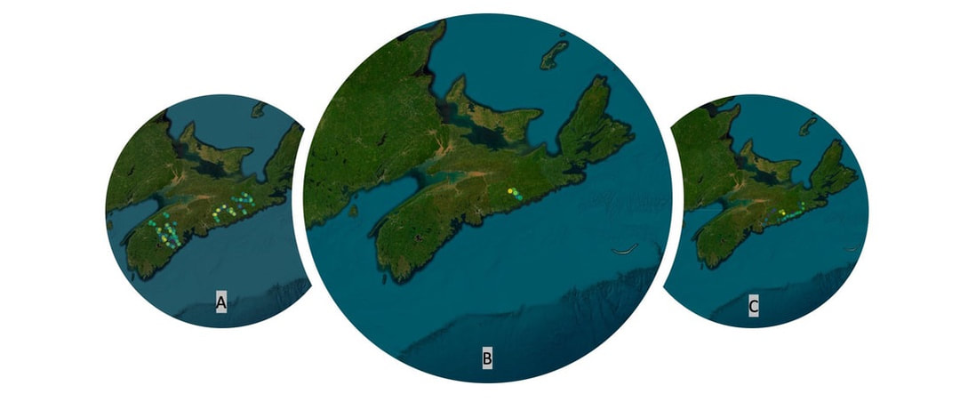 Figure 1. Map of the sites included in A) W.A.T.E.R. (Watershed Assessments Towards Ecosystem Recovery) project, B) WRSH (West River, Sheet Harbour) Acid project, and C) Oceans North project. Source: Leaflet/ Tiles © Esri-Source: Esri, i-cubed, USDA, USGS, AEX, GeoEye, Getmapping, Aerogrid, IGN, IGP, UPR-EGP, UPR-EGP, and GIS User Community. 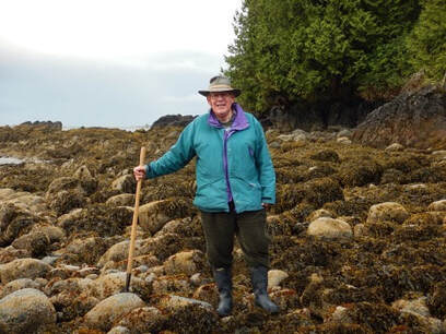 Bill Merilees at Hyphocus Island, Ucluelet, B.C. (May 11, 2017) Bill Merilees at Hyphocus Island, Ucluelet, B.C. (May 11, 2017) Data rescue intern:
Lauren Gill Bill Merilees is an accomplished naturalist who has had a long, varied, and productive career. As Bill was influenced by many people through the years, he in turn has influenced and inspired many people throughout his life... 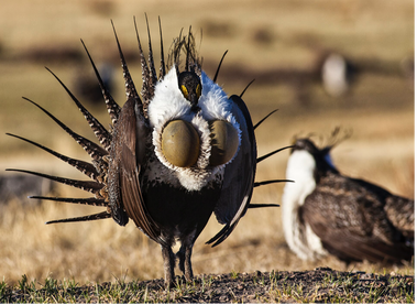 Data rescue intern:
Emily Black The greater sage-grouse (Centrocercus urophasianus) is a charismatic North American prairie bird. This species engages in a unique breeding behaviour called lekking, where males perform communal breeding displays on historic breeding grounds called leks. These breeding behaviours have led to the development of unique and exaggerated male characteristics such as brightly coloured combs above the eye, noisy mating dances (aka struts), and large inflatable air sacs on the male’s chests. digitization of museum specimens for the Lyman Entomological Museum and McGill University Herbarium10/6/2023
Data rescue intern:
Jessica Reemeyer My Data Rescue Internship focused on facilitating digitization of museum specimens for the Lyman Entomological Museum and McGill University Herbarium. Both museums had data that had been digitized but needed a database to store the data and an easier way for volunteers to upload data as they digitize new specimens. To fill these needs, I created a web-hosted SQL database for each museum. I then created a corresponding website with a webform to facilitate digitization of specimens. Data rescue intern:
Emma Menchions Background The field notes of early botanists are an undervalued source of biodiversity data. They can provide us with high quality baseline data that spans back to the time before we had heaps of species observations from community science portals like iNaturalist. The main challenge is translating this data from scribbled (and sometimes waterlogged) notes on paper to useable, clean data! Data rescue intern:
Olivia Rahn The Living Planet Index tracks long term population trends in vertebrate populations across the globe- these population trends are published as part of the WWF’s Living Planet Report. The database is curated and managed by multiple organizations, including the London Zoological Society. While the database is extensive and has been used for many different analyses of vertebrate populations, many records in the dataset are either not georeferenced or are not georeferenced using a standardized protocol. This limits the scope of analyses that can be done using the dataset- for example, analyses that integrate local climate data or land-use change data with population trends require accurate georeferencing. 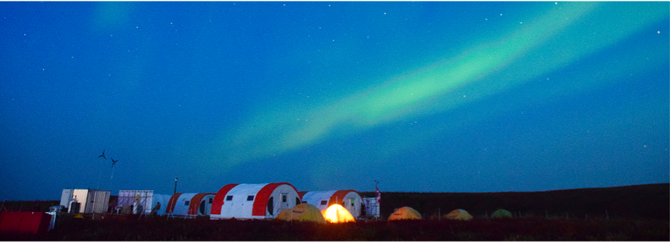 Data Rescue Intern:
Jory Griffith The Trail Valley Creek Research Station is located 50km north of Inuvik, Northwest Territories, Canada. Trail Valley Creek is an incredibly important area, as it drains 58km2 of tundra and is underlain by continuous permafrost. It is also warming at a quicker rate than most of the globe, and this warming is causing increased permafrost thaw, arctic greening, decreased snowfall, and changes in runoff. These changes have large impacts on Canada’s water resources. The Trail Valley Creek Research Station has been collecting hydrological data in this area for over 30 years. |
Archives
October 2023
Categories |
 RSS Feed